It is purportedly the intension of The Australian Institute of Marine Science (AIMS), specifically their Long Term Monitoring program, to detect changes in reef communities at a number of different scales including at the scale of the individual reef, sub-region and between the northern, central and southern Great Barrier Reef.
But. If this monitoring is not even able to detect the extraordinary damage inflicted by Tropical Cyclone Kirrily on John Brewer Reef it cannot be considered fit for purpose.
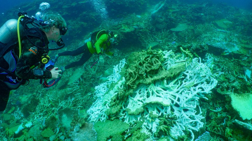
To reiterate, John Brewer reef as an ecosystem was approaching climax, in all its beauty, when it was smashed by TC Kirrily early this year, on 25th January 2024.
This severe category three cyclone sat for two long hours over the top of this spectacular mid-shelf reef unleashing such destruction and yet the AIMS’s monitoring program has no record of it. According to their monitoring program there is nothing to see, they are in denial of this cyclone.

This reef, John Brewer reef, was surveyed in March 2022 and then again in June 2024 – and yet percentage coral cover change is little change: just 23 percent before TC Kirrily to now officially 17 percent in the latest June 2024 survey – and yet so much healthy, hard coral was destroyed in between!
I explained the extent of the damage to John Brewer reef, and included photographs, in a post entitled, Cyclone Kirrily Smashed my Favourite Coral Reef.
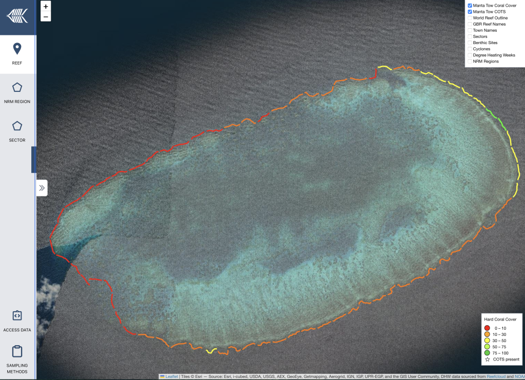
The ‘core survey reef sample’, as explained by AIMS comprises ‘Manta tow surveys, which collect information in a standard reef slope habitat around the perimeter of each reef’. The technique involves towing a snorkel diver at a constant speed behind a boat around the perimeter of each reef. Every two minutes the observer records their visual assessment of hard coral cover onto a data sheet into one of five categories that correspond to very low (0-10%), low (10-30%), medium (30-50%), high (50-75%), and very high (75-100%) hard coral cover.
In the AIMS reports, and at the AIMS website that explains this, it is emphasised that ‘the methodology is consistent’, the tow is always ‘clockwise’ around the perimeter of each reef.
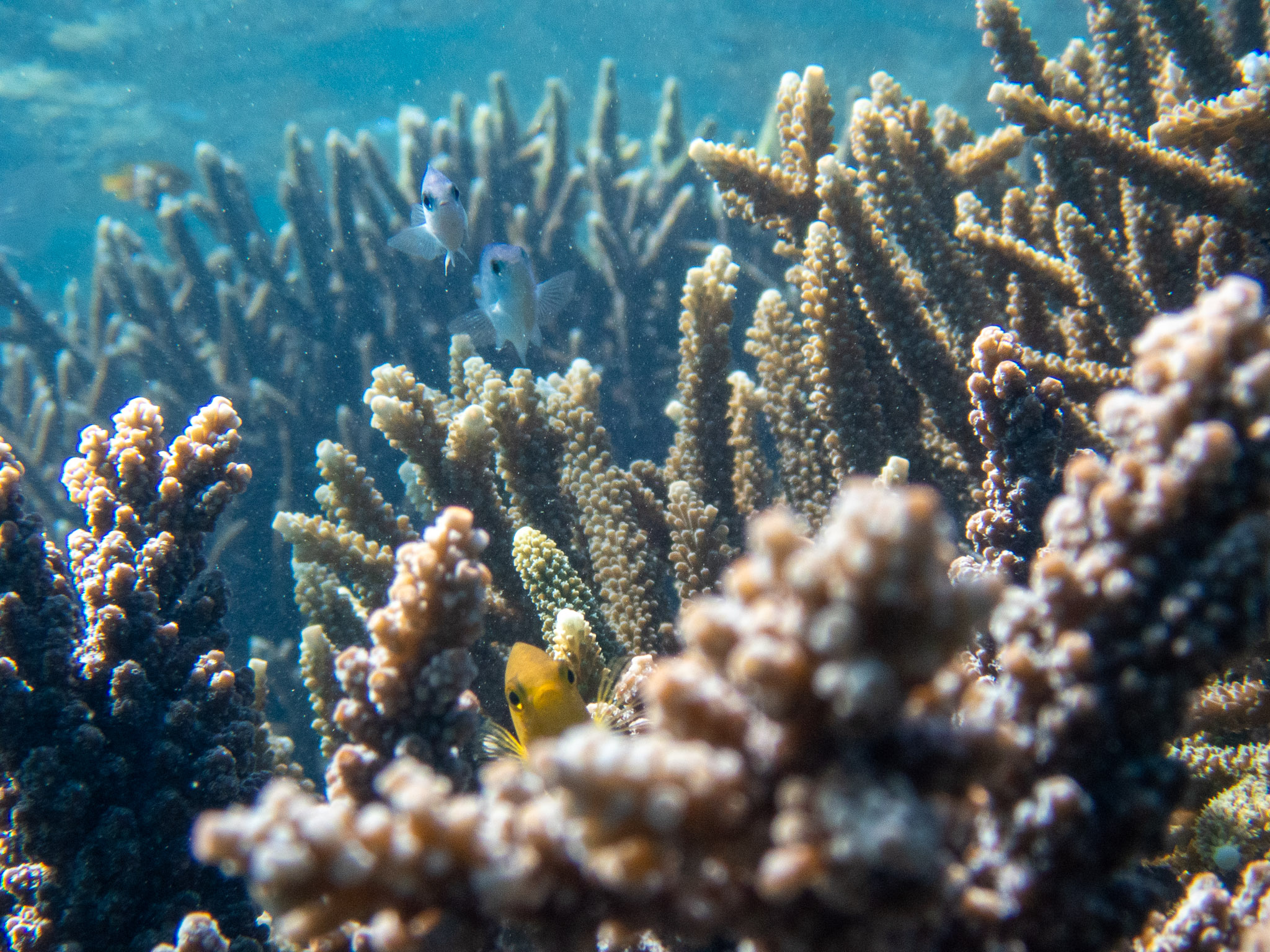
But what is the objective? If it is to be able to report on changes in hard coral cover between reefs and across regions, then the observer needs to be ‘towed’ or otherwise given access to representative reef habitats. It is pointless if the observer is towed away from the habitat where the fish tend to congregate, which is where there is more coral that is at the reef crest.
TC Kirrily did most damage at John Brewer reef in the shallower sections, including at the reef crest. Yet the manta tow surveys around the reef perimeter are typically at a depth of 8-9 metres. By their very design these surveys, that are at the core of the AIMS Long Term Monitoring program, they cannot capture disturbance from the major natural source of catastrophes that regularly befall coral reefs at the Great Barrier Reef – tropical cyclones.
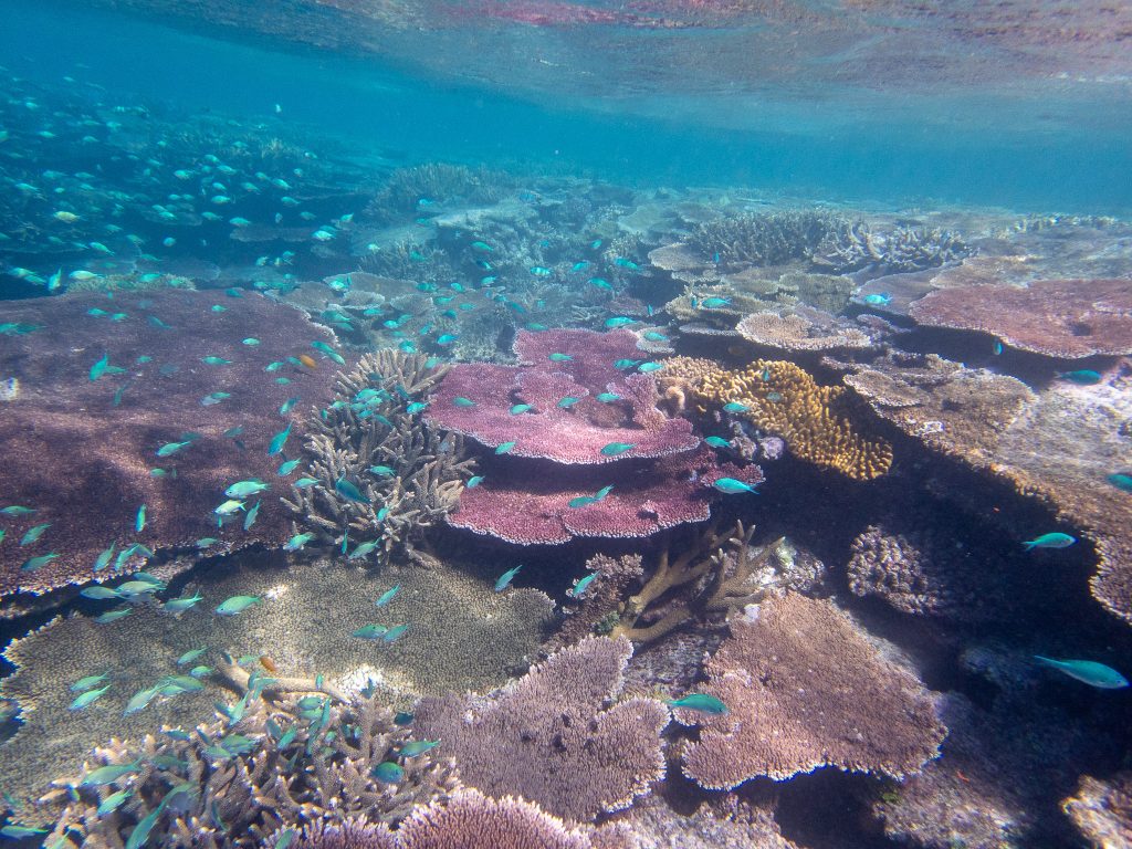
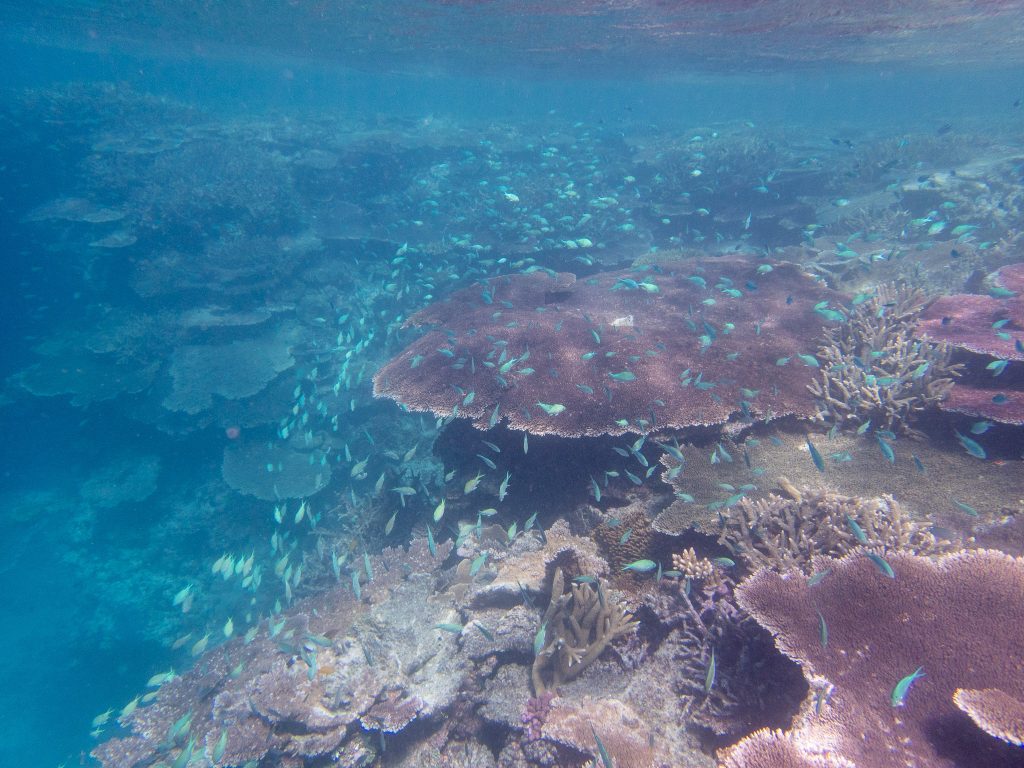
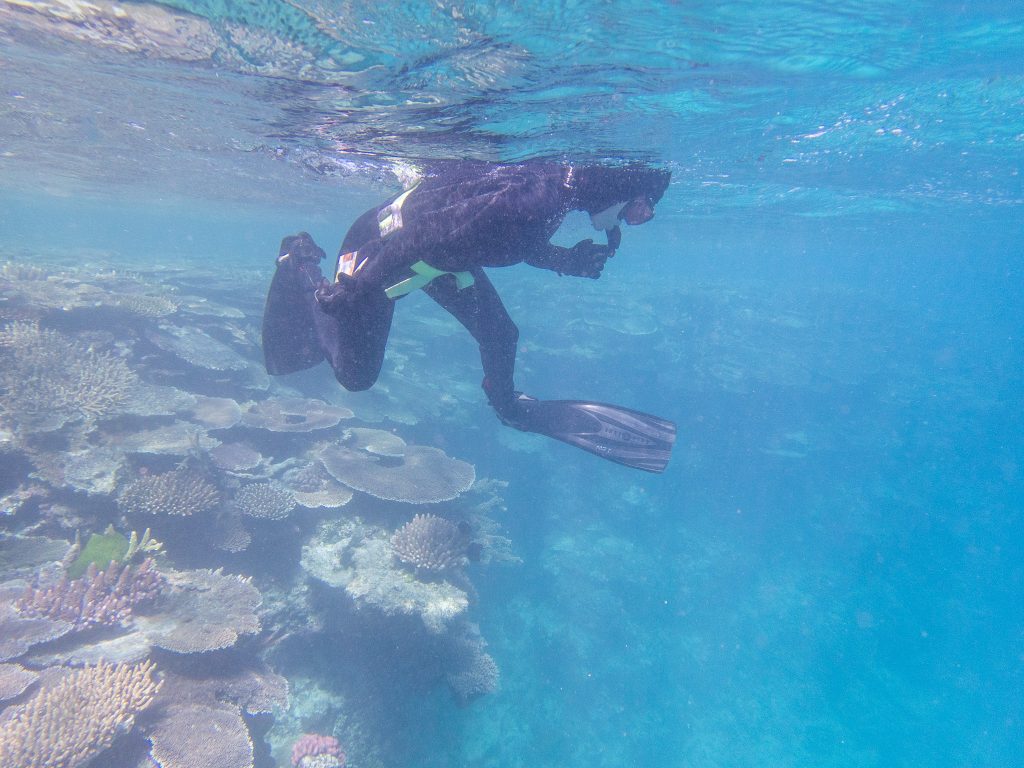
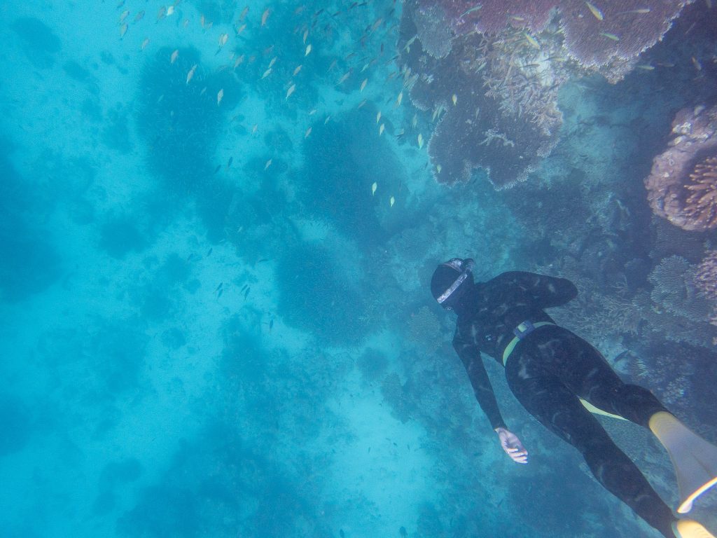
It doesn’t matter that the observer is always towed around the perimeter, and it doesn’t matter that this is always done in a clockwise direction if this is not where all the coral is, particularly the coral at a reef like John Brewer Reef before TC Kirrily – a coral reef approaching climax.
If the objective is to monitor change in coral cover, then habitats where coral is concentrated will need to be monitored as part of any program committed to understanding change.
According to Dr Mike Emslie, the leader of this project:
Information from LTMP has been instrumental in apprising the Great Barrier Reef Marine Park Authority (GBRMPA), government and stakeholders on the status of the GBR and uses web-based reporting products to ensure timely dissemination of information upon completion of each survey cruise. Upon completion of each field season, an online annual update on the status of the GBR is produced, along with substantial media exposure.
LTMP data also feeds directly into the five yearly GBR Outlook Report produced by the GBRMPA under the auspices of the Australian Governments Reef 2050 Sustainability Plan.
The monitoring program at John Brewer reef began in 1985, nearly forty years ago, yet as far as I can tell, never in all this time has any relevant data been consistently gathered about hard coral cover at the reef crest, where the coral and fish are concentrated.
If there is no relevant data, then we can’t know what the cumulative effects of more or fewer cyclones or bleaching events is on coral cover, not in any meaningful way. Yet this is one of the key tax-payer funded programs, relied upon not just by my colleague Peter Ridd, but also government and the media to know the state of the Great Barrier Reef.
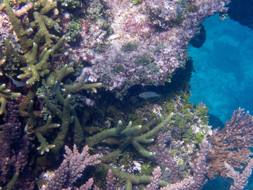
And, while there might be 3,000 coral reefs, John Brewer Reef is something of the jewel in the crown considering the central region of the Great Barrier Reef – something of greater value amongst other valuable things? This coral reef to the north-east of Townsville was once home to a floating hotel, that was back in the 1980s. More recently, and somewhat more modestly, John Brewer has been given its own Museum of Underwater Art. It does matter that we know how hard coral cover at John Brewer reef changes, and what the key drivers are, of this change.
I have found it difficult that the response of most of my colleagues to this damage, not just the scientists at AIMS, but my colleagues at the IPA and also at Sky News has been to turn away; their response has mostly also been denial. But. It does matter that we acknowledge such destruction. It does matter that we acknowledge what is happening at coral reefs like John Brewer reef, this is important for our collective conscious for the myths that emerge about who we are, and what we value.
****
I’ve cross posted some of this text at my official Facebook page, that is where there is now most public discussion about what I write. At the same time, I get little notes from Facebook warning me that I must respect ‘community standards’ and so I am never sure if I’m going to have my account there suspended. This has happened before. Of course, there is also the possibility that I could lose my Facebook account altogether; I have a habit of offending gatekeeper. Anyway, I thought it worth crossposting this comment from Facebook:

 Jennifer Marohasy BSc PhD is a critical thinker with expertise in the scientific method.

Jennifer, I feel your frustration. I hope you can continue your great work in providing actual observed evidence of the cycles of destruction and repair in these very special areas of the GBR. It is very important that AIMS is held to account, particularly as they receive public funding.
I am disappointed to hear that your colleagues at IPA and Skynews are not supporting you in your ongoing effort to set the scientific records straight. We supported Peter Ridd through his legal battles, donating to this cause. We also financially support the IPA and their ” Real Science” program. Disappointing indeed.
Thanks Barbara.
It is unfortunate that as I was explaining to my IPA colleagues the terrible state of John Brewer reef in the aftermath of TC Kirrily, Peter Ridd, with this knowledge that I had communicated to him, was invited to give this YouTube presentation that has been heavily promoted:
https://www.youtube.com/watch?v=Zd_nAxV4aW4
Then there is the claim in the text under the same presentation at Youtube: ‘Statistics from the Australian Institute of Marine Science show that the Great Barrier Reef has more coral in the last two years than at any time since records began.’
The key statistic is not an AIMS statistics, the ‘32.7 +/-0.04’ is a Peter Ridd generated statistic.
It has been endlessly promoted, this chart of record coral cover with the +/-0.04 uncertainty value, not just by Peter Ridd, but it has been republished and promoted by big names including at Jordon Peterson’s ARC conference in London and by Benny Peiser’s Global Warming Policy Institute. There are a lot of people who should know better than to republish and promote this error.
Let me explain: when considering ‘uncertainty values’ as Ridd describes it, it is worth considering the method used by the Australian Institute of Marine Science (AIMS) that has undertaken these surveys since 1984. AIMS records coral cover according to the following categories very low (0-10%), low (10-30%), medium (30-50%), high (50-75%) and very high (75-100%).
To be clear, the data is categorical. It is collected not as a continuous number, but rather it is noted that coral cover for a particular section of reef fits in a particular category.
It is impossible to calculate a standard error, by which I mean an uncertainty value of any sort, let alone one of 0.04 from data collected in the way AIMS collects their coral cover data. In order to calculate an ‘uncertainty value’ such as 0.04 it is necessary to know the sample mean.
To be clear, it doesn’t matter how many samples AIMS collect. If they only ever record that coral cover is within such broad bands as 0-10%, 75-100% etcetera it is not possible to generate a standard error because there is no sample mean, and certainty not one as small as +/-4%.
To be sure, it is all most unfortunate.
This link is significant: https://www2.gbrmpa.gov.au/our-work/programs-and-projects/reef-2050-integrated-monitoring-and-reporting-program
Clearly you have identified processes that need revision in order to produce more effective results
AIMS … and the other bodies identified, all report back through the minister for the Environment. I suspect much of your research will fall into the ‘too hard’ basket; however if it can be shown that there is a payoff, it may get noticed.
You may be amused… Or not. But just read this over in the UK
https://m.independent.ie/world-news/australasia/this-is-horrific-great-barrier-reef-footage-shows-97pc-of-coral-is-dead/a1349688844.html
The High Court unanimously dismissed [Ridd’s] appeal, saying “the intellectual freedom protected by cl 14 of the Enterprise Agreement was not a general freedom of speech”.
“The 2016 Censure and part of the basis of the Final Censure were unjustified because they related to the expression of honestly held views by Dr Ridd within his academic expertise,” the judgement said.
“The Final Censure was justified only insofar as it relied upon expressions of opinion unrelated to Dr Ridd’s academic expertise, and findings that he repeatedly failed to comply with his confidentiality obligations.
“Since Dr Ridd ran his case on an all-or-nothing basis, the termination decision was justified in its reliance upon conduct of Dr Ridd, which was the subject of 18 findings of serious misconduct which were not protected by cl 14.”
Bill,
I remain very disappointed that the Ridd court case never considered evidence for or against the original points of contention, the state of the corals in Bowen Harbour.
I ended up making some films about several of the Bowen Harbour reefs, my first film, it’s here: https://www.youtube.com/watch?v=HqFFqBuFVqU
It is the case that the Ridd court case ended up being about issues of freedom of speech and contract law, as your quote explains.
One of my blog posts following the first ‘win’ includes comment:
“It more than once crossed my mind, that with all the money floating around for reef research and lawyers … there could perhaps be some mapping, or just one transect, at this most contentious of locations supposedly indicative of the state of the Great Barrier Reef more generally.
In his judgment Judge Salvadore Vasta was left to simply conclude that it was unclear whether there was now mudflat or coral reef where an extensive area of Acropora coral had been photographed back in 1890, but that Peter Ridd nevertheless had the right to ask the question.
Indeed, the court case and the appeal which must be lodged by tomorrow (Tuesday 7th May), is apparently all about ‘academic freedom’ and ‘employment law’, while the average Australian would perhaps be more likely to care if they got to see some coral and some fish – dead or alive.
I visited Bramston Reef over Easter because I couldn’t wait any longer to know if the corals in Peter Ridd’s 2015 photographs had been smashed by Cyclone Debbie that hovered over Bowen two years later, in April 2017. [end quote]
Link here: https://jennifermarohasy.com/2019/05/corals-other-side-of-mud-flat/
After Ridd’s big loss in the High Court, and following his adjunct appointment at the IPA granted by John Roskam, I thought there might be some interest in getting out and doing some ‘real science’. But again I have been very disappointed. There is no interest, not even in seeing John Brewer reef after it was pummelled by TC Kirrily.
There is still no interest in the most fundamental: observation.
Yet for a real scientist, it is critical.
Everything must follow this, for a real scientist ‘numbers’, and how they are measured, this must follow some overview of the nature of the problem that would normally consider the distribution and abundance of the organism of interest, for example, the hard corals at a coral reef.
Perhaps Peter Ridd has always been far more interested in politics than coral, and if this is the case, he perhaps needs to begin to be more up-front about this.
The ‘Real Science’ program at the IPA lead by Peter Ridd made rehashing nonsense AIMS statistics on coral cover its focus. I’ve been explaining to Peter for at least two years that these surveys results, particularly as he presents them are misleading.
PS.
I am hoping for some more discussion about all of this, in the interests of freedom of speech and all of that. John Roskam and Peter Ridd are purportedly champions of freedom of speech and all of that.
They are not sure if biologists are real scientists, but they are sure physicists are, and that freedom of speech is good.
I did an interview with the author of a popular Substack just recently about all of this, since cyclone Kirrily and since AIMS published its most recent statistics on coral cover suggesting this cyclone had no impact on coral cover at John Brewer Reef. A most bizarre conclusion.
The Substack where my interview will be published runs with the subheading: ‘lies are unbekoming’ which seemed like a good place to start. I get quite a few requests for interviews, not from the mainstream, but by Substack authors etcetera.
My interview may be published here in the next little while: https://unbekoming.substack.com.
Of course, there will be opportunity for comment, there is a comment thread at ‘Lies are Unbekoming’.
Not so long ago New York-based statistician William M. Briggs was interviewed on climate science and more, at the same Substack site: https://unbekoming.substack.com/p/interview-with-william-m-briggs
Jennifer, I agree “it doesn’t matter how many samples AIMS collect. If they only ever record that coral cover is within such broad bands as 0-10%, 75-100% etcetera.
Much of my work involved reporting against conditions imposed on developers by the Planning and Environment Court on performance of bushland rehabilitation projects. If we produced results based on AIMS assessment criteria to assess the performance of rehabilitation projects we would be laughed out of the room.
Totally agree with you, the AIMS methodology is not for for purpose and the resulting stats are useless. Furthermore, it appears that AIMS troops and the legal eagles charged with making determinations don’t understand the basics.
Quite right “some mapping, or just one transect” would reinforce your position so keep up the good work.
Peter, the GBR is 2,300 km long, that is why broad aerial surveys with categorised condition measurements are made. This helps scientist understand the reef’s degradation. Diving on a few individual locations and swimming around for a bit is statistically meaningless, and provides no predictive value.
Karen,
Thanks for your comment in this thread, and also your request I visit Lizard Island in a previous thread. I would love it, if we could go to Lizard Island together. :-). Is there any chance you/someone else could organise some funding and travel logistics. It would be important to get to the locations that have been worst affected by the bleaching.
Regarding aerial surveys. I touch on the limitations of these in a recent interview just published at Unbekoming, that is here:
https://unbekoming.substack.com/p/the-great-barrier-reef?fbclid=IwY2xjawDtSH5leHRuA2FlbQIxMQABHWS9Wab1DKGNZ1_AifDaMI58almXd4K6u-jdivgk4Fpwb_ayvyhk4FhA_Q_aem_J-EWbNGYoZ8jgrr1kuxVYg
It includes this extract:
“I am reminded of a story Shaun Fricette told me. I spent a week at sea with Shaun a few years ago. Shaun came on the trip at short notice, wanting to know first-hand the state of the Great Barrier Reef; he had heard it was dying. He was working as a volunteer at a turtle rehabilitation centre on Fitzroy Island, which is just to the south-east of Cairns and part of the Great Barrier Reef Marine Park. Ten years earlier, he worked as a deep-sea diver in the Gulf of Mexico.
He got into deep sea diving in his late twenties because he had developed a passion for environmental issues especially marine conservation. At the time, he figured if an oil pipe was leaking on the sea floor it took a diver to go down and fix it, so he trained as a commercial diver and went to Louisiana. He did lots of diving on the oil rigs as well as working topside on saturation systems and diver tending. His goal at the time was to become a saturation diver and live life ‘like an astronaut’ except on the sea floor. To achieve that goal, Shaun knew he would have to put in years of hard work proving himself in the industry, but he never realized that the industry would meanwhile prove to care so little for life under-the-sea. For example, the oil companies, trained him to cut through steel with torches that burn at over 10 thousand degrees so that spent oil rigs could be dismantled safely – but instead they sent him down to the bottom of the ocean to plant explosives because it was faster to decommission a rig that way.
Shaun remembers:
The oil companies would send ‘turtle girls’ up in a helicopter to scout dolphins and sea turtles and if they gave the ‘all clear’ charges would go off and we would return to location. The problem was those oil rig platforms become like coral reefs after years of being submerged and the sea life around them is so biodiverse and special.
The turtle girls could only see 5 meters underwater on a good day so what I witnessed was horrific. Turtles cut in half, wounded dolphins and thousands of floating fish stunned from the explosions.
Something changed inside of me after seeing that and it’s altered my life path ever since.
The turtle girls were put in a position where they couldn’t see what they were being asked to report on, and it seems like much of the reporting of the state of the corals at the Great Barrier Reef is of an equally dubious quality.
The correct term to describe at least some of this is perhaps ‘premeditated ignorance’. END QUOTE
Maybe click across to get some idea of how some of the monitoring happens, and discrepancies between techniques, and how some of the analysis is quite bizarre.
I notice that you again claim that your use of drones refutes the validity of AIMS aerial photography. What type of camera is your drone fitted with. Are you following the same detailed guidelines for this type of survey laid out by AIMS?
Thanks Karen,
I have a DJI Mavic drone with a zoom lense. Put that up over a body of water and see how much you can see into the water from 120 metres. It does vary with the time of day and the amount of wind and how sunny the day is, but basically you can’t see far into the water even when conditions are near perfect, and then there is the issue of the coral growing down the walls/the drop offs.
The other thing I have done is visited reefs that according to aerial surveys are stuffed, and I’ve found no bleaching from an in water survey.
And while the AIMS aerial surveys were calling John Brewer reef ‘severely bleached’ in March 2022, the in water manta surveys reported no bleaching. Same organisation different method, and completely different result.
There is some discussion of this in a film I made some time ago that you can watch here:
Cheers,
Are you using a good quality digital SLR camera fitted with either a 24-70mm or a 70 – 300mm zoom lens. A circular polarising filter is essential for reducing glare and improving the clarity of underwater features and corals beneath the surface. Since the images “move” fast, use the fastest shutter speed your camera will allow in the light conditions. Shutter speeds of <1/1000th second are recommended. To achieve this, it may be necessary to reduce the F-stop (open the aperture, e.g. F1.8 – F5.6) and use a moderately high ISO number for increased light sensitivity (e.g. 800-1800 depending on the light conditions, modern full frame mirrorless cameras can use even higher ISO settings without losing pixel clarity up to 4000 or higher, but by rule use the lowest ISO settings to give less “grainy” images). Turn the automatic image stabilization feature on your camera to “ON” and try not to support the camera (or arm, shoulder, elbow) on the side of the plane to minimize image blurring due to vibration.
intention
Thanks Karen,
That is the easy stuff: correct filter and camera settings. Stabilisation is never an issue with a DJI drone. Yep. Tick.
But. Then there is the issue of how far below the water surface the corals are, visibility in-water, the extent of the surface current and swell, and on it goes.
And how is it, that in March 2020 the AIMS in-water survey reported no bleaching and yet the aerial survey reported severe bleaching …at John Brewer Reef?
Jenn, is your drone fitted with a circular polarising filter?