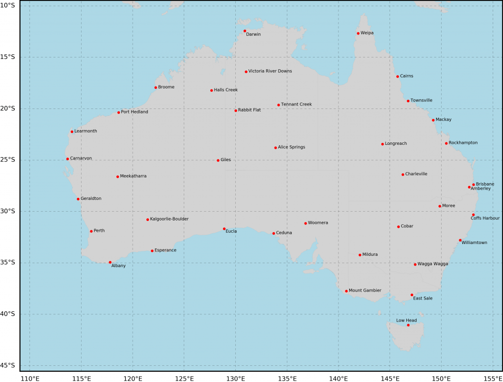
There are 38 known stations across Australia where temperature data were collected from both the older liquid-in-glass (LiG) thermometers and the newer platinum probes over extended time periods in parallel – side by side at the same weather station. These stations are shown on the map and listed below.

| # | Site name | BoM ID | Lat (°S) | Long (°E) |
|---|---|---|---|---|
| 1 | Albany Airport | 009741 | 34.94 | 117.80 |
| 2 | Alice Springs | 015590 | 23.80 | 133.89 |
| 3 | Amberley | 040004 | 27.63 | 152.71 |
| 4 | Brisbane Airport | 040842 | 27.39 | 153.13 |
| 5 | Broome | 003003 | 17.95 | 122.24 |
| 6 | Cairns | 031011 | 16.87 | 145.75 |
| 7 | Carnarvon | 006011 | 24.89 | 113.67 |
| 8 | Ceduna | 018012 | 32.13 | 133.70 |
| 9 | Charleville | 044021 | 26.41 | 146.26 |
| 10 | Cobar | 048027 | 31.48 | 145.83 |
| 11 | Coffs Harbour MO | 059040 | 30.31 | 153.12 |
| 12 | Darwin | 014015 | 12.42 | 130.89 |
| 13 | East Sale | 085072 | 38.12 | 147.13 |
| 14 | Esperance | 009789 | 33.83 | 121.89 |
| 15 | Eucla | 011003 | 31.68 | 128.90 |
| 16 | Geraldton Airport | 008051 | 28.80 | 114.70 |
| 17 | Giles | 013017 | 25.03 | 128.30 |
| 18 | Halls Creek | 002012 | 18.23 | 127.66 |
| 19 | Kalgoorlie-Boulder | 012038 | 30.78 | 121.45 |
| 20 | Learmonth | 005007 | 22.24 | 114.10 |
| 21 | Longreach | 036031 | 23.44 | 144.28 |
| 22 | Low Head | 091293 | 41.05 | 146.79 |
| 23 | Mackay | 033119 | 21.12 | 149.22 |
| 24 | Meekatharra | 007045 | 26.61 | 118.54 |
| 25 | Mildura | 076031 | 34.24 | 142.09 |
| 26 | Moree | 053115 | 29.49 | 149.85 |
| 27 | Mount Gambier | 026021 | 37.75 | 140.77 |
| 28 | Perth Airport | 009021 | 31.93 | 115.98 |
| 29 | Port Hedland | 004032 | 20.37 | 118.63 |
| 30 | Rabbit Flat | 015666 | 20.18 | 130.01 |
| 31 | Rockhampton | 039083 | 23.38 | 150.48 |
| 32 | Tennant Creek | 015135 | 19.64 | 134.18 |
| 33 | Townsville | 032040 | 19.25 | 146.77 |
| 34 | Victoria River Downs | 014825 | 16.40 | 131.01 |
| 35 | Wagga Wagga | 072150 | 35.16 | 147.46 |
| 36 | Weipa | 027045 | 12.68 | 141.92 |
| 37 | Williamtown RAAF | 061078 | 32.79 | 151.84 |
| 38 | Woomera | 016001 | 31.16 | 136.81 |

 Jennifer Marohasy BSc PhD is a critical thinker with expertise in the scientific method.
