Data from the following transect photographs will be quantified and eventually graphed. But it is also possible for the curious to examine the 360 photographs individually and draw their own conclusions about the overall state of this coral reef, and how coral cover, species diversity and colour varies with the different habitat types.
The photographs will, in due course, be supplemented with video and colour health check assessments.
Objectives
When I visited Pixie Reef on 22nd and 24th February 2021, the plan was to gather as much information and evidence as possible by way of video and photographs of the corals in three different habitat types (front, back lagoon and crest) and from this data to know the state of this reef for that moment in time. I also assessed the colour of the corals in those three habitats using the University of Queensland’s ‘coral health charts’.
As well as running transects at the reef crest, back lagoon and front, we also ran three transects from a section I’m classifying as ‘western flank’ that was about 10 metres immediately below that section of reef crest that we surveyed on 22nd. This was not part of the original plan, but these transect photograph (Table 4.1) provide a stark contrast to the photographs from the adjacent crest (Table 1.1). The idea in capturing the complexity and diversity is to be honest to the state of this reef at that moment in time.
Hypothesis
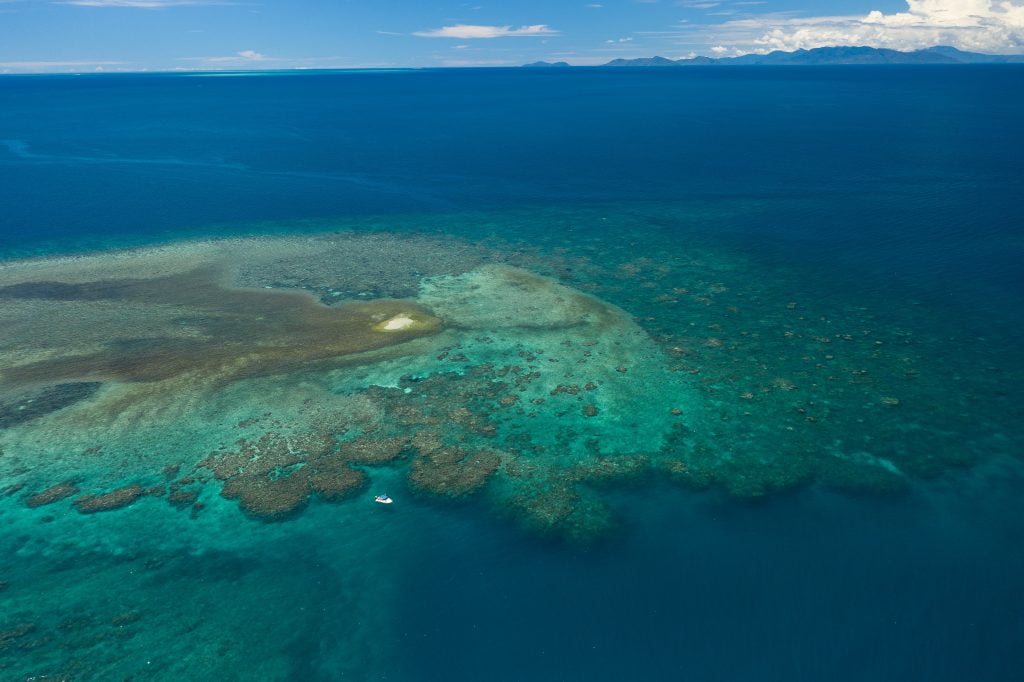
Pixie Reef is an inshore reef just 22 nautical miles to the north of the city of Cairns. It was classified as 65% bleached in March 2016 from a fly-past in an airplane at 150 metres altitude*. I hypothesise that Pixie Reef has since recovered and could now be classified as a healthy coral reef. I also hypothesis that there are significant differences in coral species diversity, coral cover, and coral colour in the different habitat types at this reef.
Funding
This work is entirely funded by the B. Macfie Family Foundation through the Institute of Public Affairs.
Method
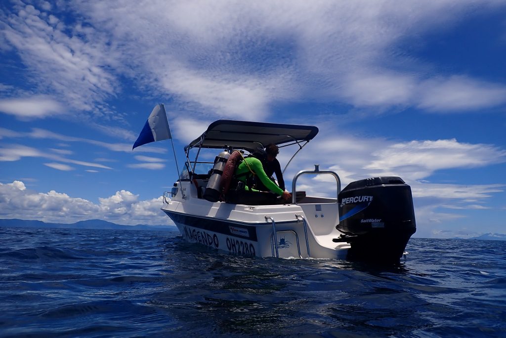
I first visited Pixie Reef last year (25th November 2020) to test a method for laying photographic transects as a measure of coral species diversity and coral cover. Aerial and horizontal transects from this visit can be viewed at the corresponding data page: Pixie Reef 2020, and there is also a blog post with more photographs. I returned with Stuart Ireland, and underwater photographer Leonard Lim, on 22nd and 24th February 2021.
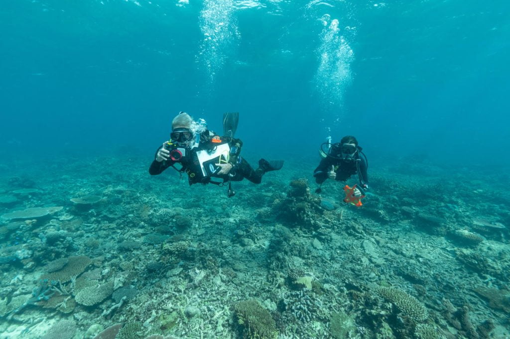
We ran 36 transects over two days, 22nd and 24th February 2021. Leo took a total of 360 photographs along the 36 transects. These photographs can be viewed in the following tables. Then there are the 72 videos (36 from a horizontal and 36 from a vertical perspective) taken by Stuart that are yet to be uploaded. I recorded more than 100 coral health checks, which are yet to be tabulated.
Stuart ran the transects following the reef contour to the extent possible, and choosing starting locations with particular features that could be identified/found during future visits. After each 10 metre transect, 10 metres was left/swam past before the next transect was laid.
Every photograph is considered a piece of data and is provided as a link from a thumbnail. Every thumbnail/photograph corresponds with a transect, and for most transects the beginning and ending latitude and longitude have been recorded and are shown in the top of the corresponding table.
Results
The following tables include all the photographic data from a total of 36 transects with 9 transects from the reef crest, 12 from the back lagoon, 12 from the reef front, and 3 from a habitat designated ‘flank’. I hypothesis that there will be statistically significant differences when the data are analysed and compared between habitats, most obviously between the crest and back lagoon.
SECTION 1. TRANSECTS RUN ACROSS THE REEF CREST
Table 1.1
Date: 22 Feb 2021Habitat: Crest
Starting locations:
Rep1: (16°32.717'S, 145°51.672'E), Rep 2: (16°32.711'S, 145°51.668'E),
Rep3: (16°32.710'S, 145°51.663'E)
| Depth | Rep | @1m | @2m | @3m | @4m | @5m | @6m | @7m | @8m | @9m | @10m |
|---|---|---|---|---|---|---|---|---|---|---|---|
| 2 | 1 | ||||||||||
| 2 | 2 | ||||||||||
| 2 | 3 |
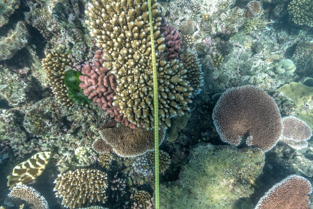
We returned to the same reef and same habitat on 24th February to gather more data: click on the thumbnails in the next table (Table 1.2) to view the corals from the reef crest as photographed on 24th February, 2021.
Table 1.2
Date: 24 Feb 2021Habitat: Crest
Locations:
Rep 1: (16°32.635'S, 145°51.848'E), Rep 2: (16°32.630'S, 145°51.855'E),
Rep 3: (16°32.629'S, 145°51.873'E), Rep 4: (16°32.627'S, 145°51.885'E),
Rep 5: (16°32.624'S, 145°51.877'E), Rep 6: (16°32.623'S, 145°51.875'E)
| Depth | Rep | @1m | @2m | @3m | @4m | @5m | @6m | @7m | @8m | @9m | @10m |
|---|---|---|---|---|---|---|---|---|---|---|---|
| 2 | 1 | ||||||||||
| 2 | 2 | ||||||||||
| 2 | 3 | ||||||||||
| 4 | 4 | ||||||||||
| 2 | 5 | ||||||||||
| 2 | 6 |
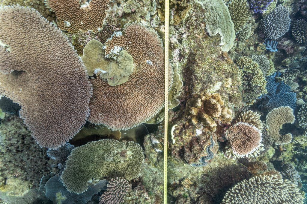
Most of the transects were run at 2 metres depth, however, transect number 4 was at 4 metres depth as the crest seemed to dip down here and we just kept running the transects consecutively: photographing 10 metres, swimming over 10 metres and then laying another transect. So, to see the corals at the transect at 4 metres depth, which was also the fourth transect, at Table 1.2: go down four rows and you can see each of the photographs taken on the one metre mark along the tape measure. If you go along two columns (taking you to @2metres along the tape measure) you can see a little clam amongst the corals.
Eventually I hope to have tables and charts with numbers extracted from these transects photographs providing summary information on percentage coral cover, coral species diversity and colour. The plan is to sort and analysis firstly by habitat type, but also considering different depths.
SECTION 2. TRANSECTS FROM THE SOUTH WEST OF THE BACK LAGOON
Table 2.1
Date: 22 Feb 2021Habitat: Back Lagoon
Starting locations:
Rep 1: (16°32.853'S, 145°51.576'E), Rep 2: (16°32.853'S, 145°51.573'E),
Rep 3: (16°32.847'S, 145°51.566'E), Rep 4: (16°32.884'S, 145°51.542'E),
Rep 5: (16°32.895'S, 145°51.542'E), Rep 6: (16°32.896'S, 145°51.544'E)
| Depth | Rep | @1m | @2m | @3m | @4m | @5m | @6m | @7m | @8m | @9m | @10m |
|---|---|---|---|---|---|---|---|---|---|---|---|
| 5 | 1 | ||||||||||
| 5 | 2 | ||||||||||
| 5 | 3 | ||||||||||
| 9 | 4 | ||||||||||
| 10 | 5 | ||||||||||
| 10 | 6 |
We returned to a similar, but not the same, location on 24th February to gather more data/photographic transects from the back lagoon. This habitat is more variable that the reef crest.
Table 2.2
Date: 24 Feb 2021Habitat: Back Lagoon
Starting locations:
Rep 1: (16°32.756'S, 145°51.566'E), Rep 3: (16°32.761'S, 145°51.588'E)
| Depth | Rep | @1m | @2m | @3m | @4m | @5m | @6m | @7m | @8m | @9m | @10m |
|---|---|---|---|---|---|---|---|---|---|---|---|
| 5 | 1 | ||||||||||
| 5 | 2 | ||||||||||
| 5 | 3 |
I have received some feedback from a collegue that it would be wrong to incorporate corals from different depths into the one analysis (e.g. Table 2.1 has photographs from the back lagoon taken at 5 metres and also 10 metres). It is the case that all the official reporting on reef health either combine data from the different habitats without attribution to arrive at a single percentage coral cover for each reef (e.g. the AIMS surveys) or only survey one habitat type (e.g. Terry Hughes and his flypasts) and from that draw conclusions about the entire reef.
Table 2.3
Date: 24 Feb 2021Habitat: Back Lagoon
Starting location: (16°32.663'S, 145°51.888'E)
| Depth | Rep | @1m | @2m | @3m | @4m | @5m | @6m | @7m | @8m | @9m | @10m |
|---|---|---|---|---|---|---|---|---|---|---|---|
| 11 | 1 | ||||||||||
| 10 | 2 | ||||||||||
| 10 | 2 |
The coral was so much sparser at ten and eleven metres depth in the back lagoon.
SECTION 3. TRANSECTS FROM THE REEF FRONT, EASTERN SIDE
More usually, the prevailing wind is blowing onto this reef from the south east/from the front making access to this front section of the reef difficult. But on 22nd February the wind was blowing from the north northwest, and we went back again to this section of reef on 24th February to ensure we had enough replications.
Table 3.1
Date: 22 Feb 2021Habitat: Front
Starting location: (16°32.826'S, 145°51.940'E)
| Depth | Rep | @1m | @2m | @3m | @4m | @5m | @6m | @7m | @8m | @9m | @10m |
|---|---|---|---|---|---|---|---|---|---|---|---|
| 2-3 | 1 | ||||||||||
| 2-3 | 2 | ||||||||||
| 2-3 | 3 | ||||||||||
| 6 | 1 | ||||||||||
| 6 | 2 | ||||||||||
| 6 | 3 |
Table 3.2
Date: 24 Feb 2021Habitat: Front
Starting locations:
Rep 1: (16°32.778'S, 145°51.972'E), Rep 2: (16°32.787'S, 145°51.977'E),
Rep 3: (16°32.795'S, 145°51.981'E)
| Depth | Rep | @1m | @2m | @3m | @4m | @5m | @6m | @7m | @8m | @9m | @10m |
|---|---|---|---|---|---|---|---|---|---|---|---|
| 6 | 1 | ||||||||||
| 6 | 2 | ||||||||||
| 6 | 3 |
Click on the thumbnails in Table 3.2 to view the corals from the reef front at six metres depth as photographed on 22nd February. For example, the photograph at the thumbnail seven across and three down corresponds with the corals at a depth of six metres, seven metres along the third transect.
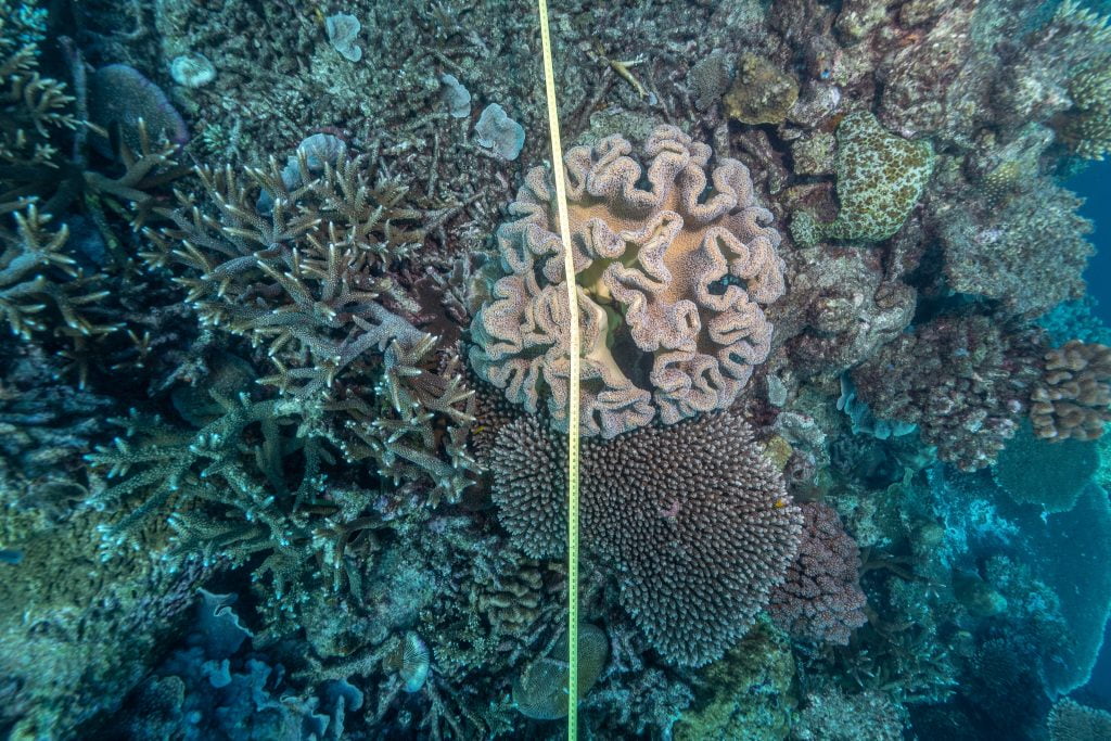
Table 3.3
Date: 24 Feb 2021Habitat: Front
Starting locations:
Rep1: (16°32.758'S, 145°51.964'E), Rep 2: (16°32.773'S, 145°52.003'E),
Rep3: (16°32.794'S, 145°51.957'E)
| Depth | Rep | @1m | @2m | @3m | @4m | @5m | @6m | @7m | @8m | @9m | @10m |
|---|---|---|---|---|---|---|---|---|---|---|---|
| 3 | 1 | ||||||||||
| 3 | 2 | ||||||||||
| 3 | 3 |
SECTION 4. TRANSECTS FROM THE REEF FLANK, WESTERN SIDE
It wasn’t part of the original plan to run transects in this section, and if we hadn’t we would have a full complement of 12 transects for the reef crest. But what a contrast these transect photographs provide, they are at the bottom of the wall that drops down vertically from the reef crest.
Table 4.1
Date: 22 Feb 2021Habitat: Western Flank
Starting locations:
Rep1: (16°32.711'S, 145°51.664'E), Rep 2: (16°32.714'S, 145°51.655'E),
Rep3: (16°32.711'S, 145°51.654'E)
| Depth | Rep | @1m | @2m | @3m | @4m | @5m | @6m | @7m | @8m | @9m | @10m |
|---|---|---|---|---|---|---|---|---|---|---|---|
| 10 | 1 | ||||||||||
| 8 | 2 | ||||||||||
| 7 | 3 |
Discussion
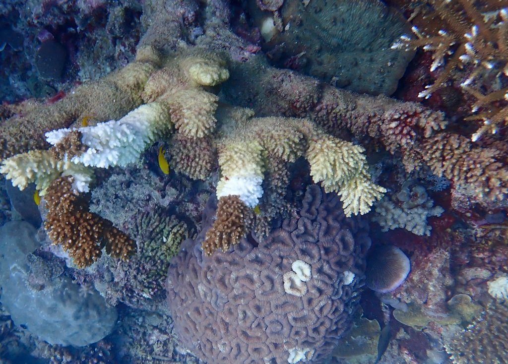
After analysis of these photographs by habitat type it should be possible to draw some objective conclusions about the state of this reef for that moment in time. In the first instance, I am simply making the photographs publicly available. This is important, because according to the peer-reviewed technical literature this reef is dead, or at least ‘half dead’. While there was significant bleaching of parts of the Great Barrier Reef in early 2016, coral reefs are resilient and they can recover. We can not know the state of Pixie Reef back in 2016 until key government institutions make their photographs from that moment in time publicly available.
Jennifer Marohasy
21st March 2021
*About the fly-pasts
I live in the state of Queensland, and the Great Barrier Reef – a global icon increasingly used as a symbol of environmental malaise and/or imminent catastrophe – stretches almost the entire coastline. One of the coral reefs officially categorized as ‘worst’ bleached is Pixie reef, just 40 kilometers (22 nautical miles) to the north east of the city of Cairns.
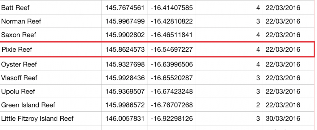
On 22nd March 2016, Terry Hughes from James Cook University looked out the window of an airplane from 150 metres altitude and gave this reef a score of ‘4’ that corresponds with more than 65% bleached. During the months of March and April 2016 he scored more than one thousand reefs, and subsequently published a peer-reviewed paper in the journal Ecology (volume 99, issue 2) claiming the Great Barrier Reef was more than 65% bleached, which was reported in media headlines around the world as the the Great Barrier Reef being more than half dead.
My hypothesis is that the Great Barrier Reef is in good health. Some coral reefs, including Pixie Reef, may have been badly bleached in March 2016 (corresponding with a period of minimum lunar declination/minor lunar standstill) but we can not know the extent of this until we are provided with more than the score ‘4’ based on an aerial fly-past.
Does Professor Hughes have any aerial or underwater photographs of Pixie Reef from March 2016, when so many coral reefs were badly bleached?
About 10% of the reefs that Professor Hughes surveyed from 150 metres altitude also had transects laid under-the-water across their reef crests. But is there any photographic evidence archived? Are there any photographs? Is there any evidence of the state of the reef crest at Pixie for this moment in time?
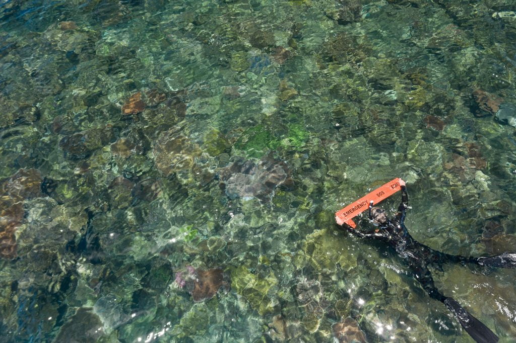
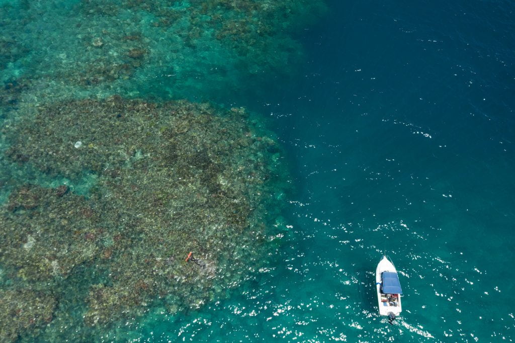
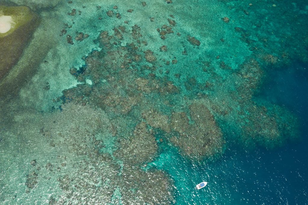
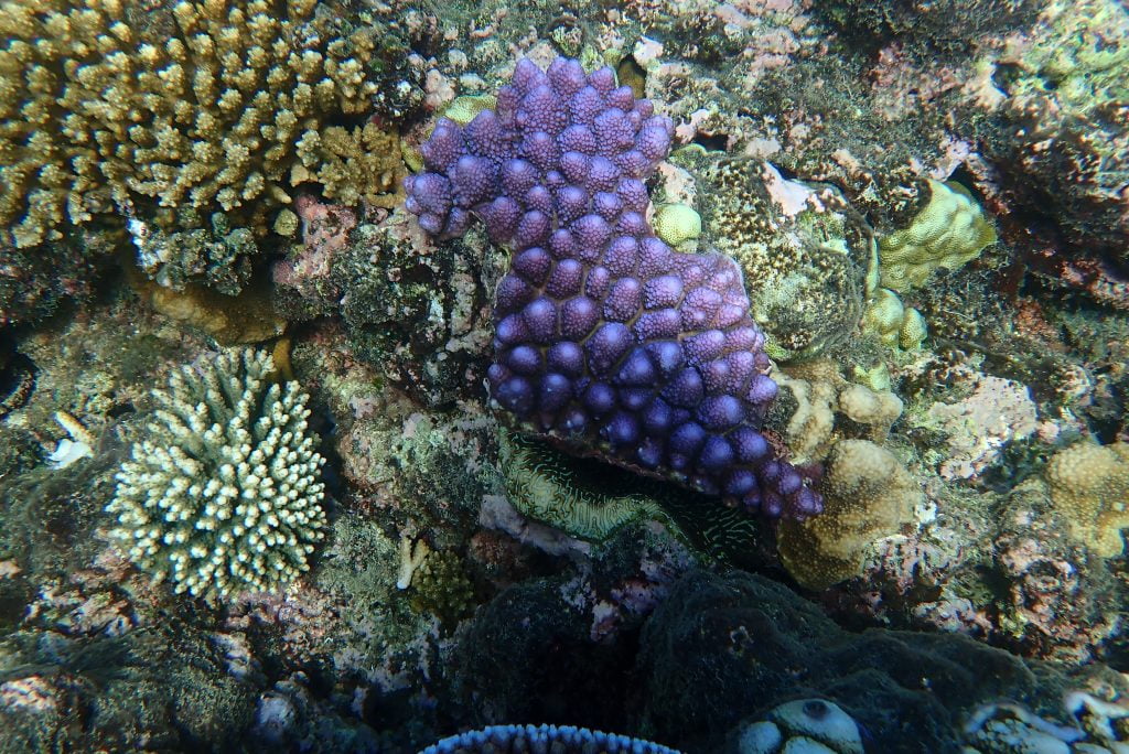
From an altitude of just 5 metres above a coral reef it is possible to see that there are plate corals of a particular colour, as shown in the drone aerial that is Figure 2. At an altitude of 40 metres it is just possible to make-out one metre of orange plastic (diameter 15 centimetres), as shown in Figure 3. At an altitude of 120 metres it is practically impossible to see even the one metre of orange plastic, as shown in Figure 4).

 Jennifer Marohasy BSc PhD is a critical thinker with expertise in the scientific method.
